onX Backcountry Trail Maps GPS
- 4.3
- Rating
- 500.00K
- Installs
- Free
- Price

 Analysis by App-foxy
Choosing a trail-navigation app is less about finding the prettiest map and more about deciding what kind of planning you actually do. I look for three things first: whether the map helps me make a decision before I leave, whether it remains useful when a trip becomes complicated, and whether the price makes sense for how often I go outside. onX Backcountry Trail Maps GPS is built for hikers, mountain bikers, and skiers who want more than a simple line showing their current position.
Developed by onXmaps, this free sports app combines GPS navigation, detailed map views, three-dimensional terrain, and guidebook-style information. It is available for Everyone and works on Android devices running version 8.0 or later. The current release is version 26.6.0, and the app has passed 500K installs, which gives it a meaningful user base without making it feel like a generic map product aimed at everyone.
My overall impression is that it makes the most sense for people who plan outdoor trips rather than simply checking their location after getting lost. It can be a strong choice when terrain, route character, and seasonal activity matter. It is less compelling if all you need is a basic map, a quick way to record a walk, or a completely free navigation tool with no paid upgrade pressure.
You May Also Like

 Blood Strike: 2.5 Anniversary
Blood Strike’s Loadouts Turn Every Drop Into a Tactical Gamble
A close look at Blood Strike’s custom loadouts: how fast access to signature weapons reshapes its battle royale rhythm, rewards preparation, and narrows the gap between fights.

 Pandora - Music & Podcasts
Pandora’s Music Is Easy to Start, but Harder to Recover
Pandora’s strength is its low-effort path from a seed to a station. Its weak spot is how much confidence it asks you to place in connection, setup, and quiet recovery.

 8 Ball Pool
 Is Built on Rivalries, Rematches, and Routine
A close look at the rivalries, rematches, shared routines, and unanswered safety questions that turn a quick pool match into a persistent mobile community.

 Samsung Music
’s Quiet Strength Is Playing What You Already Own
Its reach comes less from spectacle than from dependable access to a personal library. That simplicity is both the app’s strongest retention engine and its ceiling.

 AccuWeather: Weather Radar
AccuWeather Review: A Quick, Clear Forecast for Everyday Decisions
For everyday plans, the best forecast is the one you can understand quickly. AccuWeather makes rain timing, radar, and local conditions easy to act on, with a few trade-offs.

 Hill Climb Racing
Why Hill Climb Racing Still Turns Crashes Into One More Run
A tiny car, a bumpy hill and one more upgrade: Hill Climb Racing keeps resurfacing because its simple chaos makes every near-miss feel personal.
More From Our News Desk



How I would decide whether it fits my trips
I would judge the fit by looking at the trips I actually take, not by how impressive a map looks on a phone. In this section, I’d weigh whether terrain research and route comparison would change my plans often enough to become part of my routine. That makes it easier to see where the app earns a regular place rather than a brief first-week tryout.
Start with the kind of adventure you take
The app’s biggest advantage appears when a route needs context. A normal phone map can tell me where roads and broad paths are, but that is not always enough for a mountain outing. I may need to understand how a trail climbs, whether a slope looks approachable, how a route connects with nearby terrain, or whether a planned outing is realistic for the time and conditions available.
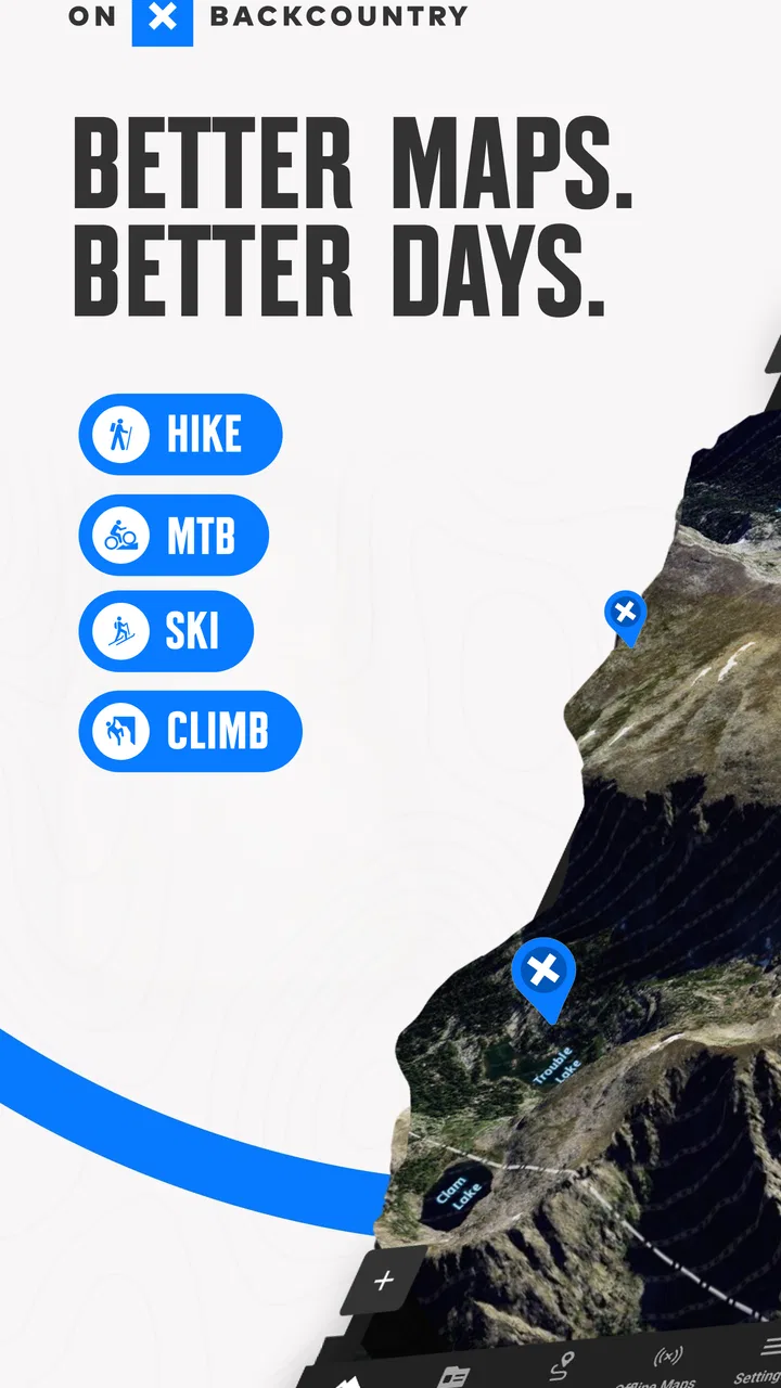
That is where the combination of GPS and three-dimensional maps becomes relevant. I can use the map not only to follow a line but also to form a mental picture of the landscape before starting. For hiking, this helps with judging the shape of a route. For biking, it can make route selection more deliberate. For skiing, the terrain view is especially useful as a planning aid because a flat map can hide how different parts of a mountain relate to one another.
I would not choose it solely because it includes a GPS marker. Many outdoor apps do that. I would choose it when I want the map to support a chain of decisions: where to begin, which route to consider, how the terrain changes, and what information I should review before committing to the outing.
Think about planning, not just navigation
A useful test is to imagine opening the app the evening before a trip. If I am deciding between several hikes, I want to compare the shape and setting of the routes rather than picking the first result. The guidebook-style material can add useful background to that process, while the map gives me the spatial view. This is more helpful than treating the app as a digital replacement for a paper trail sign.
One practical workflow is to begin with the broad area, inspect the surrounding terrain, and only then focus on a specific route. I find this reduces the common mistake of selecting a trail because its name sounds appealing while overlooking how it fits into the rest of the landscape. After that, I can use GPS during the outing as a confirmation tool instead of constantly stopping to wonder whether I am still following the intended path.
The important distinction is that onX Backcountry is a planning companion with navigation included, not merely a moving dot on a map. That difference matters most to people who explore unfamiliar places or who like to prepare several options before leaving home.
Check your phone and your habits before paying
The app is free to download, so trying its basic experience is straightforward. However, in-app purchases range from $14.99 to $99.99 per item. That broad range means I would avoid assuming that every useful map or planning capability is included at no cost. Before relying on it for regular trips, I would open the areas I care about and see which parts of the experience are available without upgrading.
This is also where personal frequency matters. Someone who takes one occasional local walk may find a standard map app sufficient. A person who regularly plans hikes, bike rides, or ski days may get more value from paying for a more specialized outdoor mapping experience. The right question is not whether the purchase is cheap in isolation, but whether it replaces several separate planning habits that I would otherwise handle with scattered maps, notes, and web searches.
Because the minimum operating system is Android 8.0, most reasonably current Android phones should be able to install it, but I would still check the device before planning around the app. I would also treat the phone itself as one part of the system. Battery condition, screen visibility, and the ability to keep the device protected in changing weather can matter just as much as the software.
Where the app earns its place
For me, lasting value comes from solving a recurring planning problem: choosing between routes, understanding the land, or preparing for an unfamiliar area. The next section looks at the specific moments when those tools can save effort and improve a decision, especially when a trip involves more than following a familiar path.
Three-dimensional terrain changes route decisions
The three-dimensional view is not just decoration. I find it most useful when a two-dimensional map makes a route look deceptively simple. Looking at terrain from an angled perspective can help me understand whether a trail is tucked into a valley, crosses a broad slope, or approaches a more exposed-looking area. It does not replace local judgment or current conditions, but it improves the first stage of planning.
A realistic example would be a Saturday hike in an unfamiliar mountain area. I might have enough time for a moderate outing but not for an ambitious route that climbs sharply near the end. With a conventional map, I could follow the route line and read whatever elevation information is available. With the three-dimensional view, I can inspect the route’s relationship to the surrounding land before I leave. That may lead me to choose a shorter alternative or plan a turnaround point earlier.
The same feature can help a mountain biker avoid choosing a route based only on distance. Two trails of similar length can feel completely different when their terrain is arranged differently. The visual model encourages me to consider the shape of the ride, not just the number of miles shown on a screen.
Guidebook information adds a human layer
Maps are excellent at showing where something is, but they are not always good at explaining why a route might suit a particular day. The guidebook element gives the app a more editorial feel. I can use it to narrow my choices and get a sense of what kind of outing I am looking at before switching into navigation mode.
This is especially helpful when I am planning with another person. Instead of sending a bare map pin and asking whether a route seems interesting, I can use the route’s descriptive context as part of the conversation. It makes the selection process less mechanical. For families or mixed-ability groups, that can help avoid choosing an outing that sounds attractive but does not match everyone’s comfort level.
I still would not treat guidebook material as a guarantee of current trail conditions. Weather, closures, snow, fallen trees, erosion, and personal fitness can change the practical difficulty of a route. I use the information to create a shortlist, then apply common sense and local checks before setting out.
GPS is most valuable when used quietly
Many people use navigation apps by staring at the screen every few minutes. I think this wastes both attention and battery. With this app, I prefer to study the route beforehand, keep the phone accessible, and use the GPS position for occasional confirmation at junctions or uncertain sections. That workflow lets me enjoy the outing while still having a reliable reference.
For a bike ride, I might review the route at home, note the main turns, and then glance at the screen only when the trail network becomes confusing. For a ski day, I would use the map to understand the area before moving and then keep navigation secondary to visibility, snow conditions, and the people around me. The app supports this approach because its value is not limited to turn-by-turn directions.
One less obvious benefit is psychological: having a clear map can make me more willing to explore a side route while still understanding how to reconnect with the main plan. That does not mean I should wander without limits. It means the app can reduce the anxiety of exploring when I have already studied the surrounding layout.
The interface suits people who prepare in layers
I like tools that let me move from broad planning to detailed checking without changing apps. onX Backcountry follows that pattern: I can start with the area, move into the terrain, consider route information, and then use GPS when I am outside. That layered workflow is more natural for serious recreational users than an app that opens directly into a recording screen.
It also makes the product useful for different levels of experience. A beginner can use the visual context to understand a route better, while a more experienced outdoor user can use it to compare options and prepare contingencies. The app does not automatically make a difficult trip safe, but it can make the planning conversation more informed.
Where another kind of app may fit better
Specialist navigation is not automatically better for every outing, and a more focused or simpler tool can be the sensible choice. I’d consider what you want from your phone—terrain context, exercise tracking, quick directions, or a narrow professional workflow—before settling on one. The next section weighs those alternatives against the kind of trips this app is made to support.
A basic map app may be enough for simple outings
If my usual activity is a paved park walk or a familiar neighborhood ride, I would probably not need a specialist backcountry tool. A general map app is often faster for finding an address, checking roads, or sharing a meeting point. Adding a dedicated outdoor app to that routine may create more complexity than value.
The same applies to someone who wants only a lightweight activity tracker. If the main goal is counting time, distance, or exercise sessions, a fitness-focused product may feel more direct. onX Backcountry is aimed at understanding outdoor routes and terrain, so its strengths can feel unnecessary when the map itself is not central to the activity.
Offline expectations deserve careful attention
When I use any navigation app away from reliable service, I want to know exactly what will remain available. The sensible habit is to prepare the area before leaving rather than assuming that a signal will appear when needed. I would open the relevant map, review the route, and make sure I understand the plan before heading into a place where connectivity may be inconsistent.
This is not a criticism unique to this app; it is a general rule for phone-based outdoor navigation. Still, it affects the buying decision. If offline access is essential to your trips, test that workflow personally before depending on the app. Do not wait until you are at a trailhead to discover that your preferred map or route information requires a step you have not completed.
I also carry a backup plan. That might be a printed reference, a written route outline, or simply a clear understanding of the main junctions. A phone app is convenient, but it remains dependent on a charged device and sensible preparation.
Specialist users may want a narrower tool
Someone who needs highly focused professional mapping, advanced field data, or a very particular sport-specific workflow may prefer a tool designed around that exact requirement. I would not describe this app as a universal replacement for every outdoor mapping system. Its appeal is its balance between route discovery, terrain visualization, guidebook context, and GPS.
Likewise, users who strongly dislike subscription-style upgrades may hesitate when they see the in-app purchase range. The free entry point makes experimentation easy, but regular use may lead to a decision about paid content. I would make that decision only after testing the areas and activities that matter to me, rather than paying based on the general promise of a specialized map.
Do not confuse visual confidence with field certainty
The three-dimensional view can make a route easier to understand, but it cannot show every real-world complication. A screen may help me see the broad shape of a slope while telling me nothing about ice, mud, fallen branches, crowds, visibility, or a change in my own energy. This is an important trade-off: better preparation can improve judgment, but it can also create false confidence if I stop checking conditions.
I would be especially cautious when planning ski outings or steep mountain routes. The app can support route awareness, but it should sit alongside current forecasts, local information, appropriate equipment, and conservative decisions. If the conditions are uncertain, the correct response is not to trust the map more intensely.
What switching to it really involves
Changing apps involves more than installing something new: I’d want to test the map on familiar ground, learn a repeatable planning routine, and decide whether any paid option addresses a real need. That small trial also shows whether the app fits how you prepare and navigate, before you depend on it for a serious trip.
The first setup is a planning exercise
Moving from a general map app to onX Backcountry is not difficult, but the benefit does not appear automatically. I would begin by choosing a familiar local route and comparing how I plan it in the new app. That gives me a low-risk way to learn the map controls, inspect the terrain view, and decide whether the guidebook material adds anything to my routine.
After that, I would test a route I know well. Familiar ground is useful because I can notice whether the display helps me understand junctions and terrain or simply gives me another version of information I already have. This is a better test than opening an impressive-looking mountain area and assuming the app will transform every future trip.
My next step would be to prepare one realistic outing from beginning to end: select the area, review the route, inspect the terrain, check the phone’s readiness, and use the GPS during the trip without constantly watching the screen. If that sequence feels natural, the app is probably earning its place.
Paid features should solve a real problem
Since the app is free to start but includes purchases from $14.99 to $99.99 per item, I would connect any upgrade to a specific need. For example, the need might be better preparation for repeated trips in a particular kind of terrain or a more complete planning workflow. I would not pay simply because a premium label appears.
This approach also protects occasional users. If I only take a few outings each year, the free experience may be enough for exploring the interface and deciding whether a purchase is justified. If I spend many weekends hiking, biking, or skiing, the cost becomes easier to evaluate against the time saved during planning and the convenience of keeping route information in one place.
Build a backup habit before your first serious trip
The best switching habit is to treat the app as part of a preparation routine rather than the entire safety plan. I would charge the phone, review the route while at home, make note of important junctions, and tell someone where I intend to go. On the trail, I would use GPS as a reference and keep an eye on the environment instead of allowing the screen to dictate every decision.
This workflow is one of the app’s strongest practical use cases. It turns the phone from a last-minute rescue tool into a planning instrument. It also exposes its limitations early, when I still have time to adjust the route or choose a different navigation method.
My recommendation after weighing the trade-offs
I recommend onX Backcountry to hikers, mountain bikers, and skiers who want terrain-aware planning and who enjoy preparing an outing before they start it. The blend of GPS, three-dimensional maps, and guidebook-style route context gives it a clearer purpose than a basic location tracker. I especially like it for unfamiliar areas, route comparisons, and trips where the shape of the landscape matters as much as the path itself.
I would recommend starting with a familiar local outing, then testing the exact activity you care about. That tells you more than any general description. Pay attention to whether the map helps you make better decisions, whether the interface feels comfortable outdoors, and whether the available free experience answers your needs before considering an in-app purchase.
I would skip it if my outdoor life is limited to simple, familiar routes, if I want only exercise tracking, or if I am unwilling to prepare a phone-based navigation tool carefully. I would also look elsewhere if I need a highly specialized professional mapping workflow rather than a balanced recreational product.
With an average rating of 4.3 from around 2.3 thousand ratings and more than 850 written reviews, the app has earned a generally positive reception. Those figures do not replace personal testing, but they fit my experience: this is a capable outdoor planning app with a clear audience, not a universal answer for every map user.
My final view is straightforward. Downloading it is easy because the app is free, and trying it costs little beyond a few minutes of setup. For the right person, the real benefit is not simply seeing a GPS position; it is arriving at the trail with a better understanding of the terrain and a more realistic plan. If that is how you like to travel outdoors, onX Backcountry Trail Maps GPS is worth putting through its paces before your next adventure.
FAQs for onX Backcountry Trail Maps GPS
01What is onX Backcountry Trail Maps GPS and what does it offer?
onX Backcountry Trail Maps GPS is a comprehensive outdoor navigation app designed for hikers, skiers, and outdoor enthusiasts. It provides detailed trail maps, GPS tracking, weather updates, and offline access to ensure a safe and informed adventure. The app also features customizable waypoints and trip planning tools to enhance your outdoor experience.
02Is onX Backcountry Trail Maps GPS available offline?
Yes, onX Backcountry Trail Maps GPS offers offline capabilities, allowing users to download maps and access them without an internet connection. This is particularly useful in remote areas where cellular service may be unavailable, ensuring that you remain on track and informed regardless of your location.
03Can I use onX Backcountry Trail Maps GPS for both hiking and skiing?
Absolutely. onX Backcountry Trail Maps GPS is versatile and caters to a variety of outdoor activities, including hiking and skiing. The app provides specific trail information, elevation data, and weather conditions tailored to each activity, making it a valuable tool for multi-sport adventurers.
04How accurate is the GPS tracking in onX Backcountry Trail Maps GPS?
The GPS tracking feature in onX Backcountry Trail Maps GPS is highly accurate, utilizing your device's built-in GPS to provide real-time location data. This ensures precise navigation and tracking, helping you stay on course. However, accuracy may vary depending on your device and environmental conditions.
05What are some potential drawbacks of using onX Backcountry Trail Maps GPS?
While onX Backcountry Trail Maps GPS is feature-rich, some users may find the subscription costs a drawback, as premium features require a paid plan. Additionally, the app might consume significant battery life during prolonged use, so carrying a portable charger is recommended for longer trips.
Pros
- Intuitive user interface for easy navigation.
- Detailed offline maps for remote areas.
- Includes real-time weather updates.
- Customizable trail markers and notes.
- Comprehensive trail and terrain data.
Cons
- Premium features require subscription.
- Occasional GPS signal issues in dense areas.
- Limited social sharing options.
- Battery drain with prolonged use.
- Updates can be slow in rural zones.

onX Backcountry Trail Maps GPS
Gallery